


🩸 RED BLOOD JOURNAL TRANSMISSION
Archive: The Archive of Blood & Memory
Division: Geo-PsyOps & Border Architecture Unit
Transmission Code: RBJ-2026-GLOBAL-FRAGMENTATION-PROTOCOL-0980
Classification: RESTRICTED // PATTERN ANALYSIS DOSSIER
Desk: San Diego Outpost
Status: ACTIVE
PROLOGUE — THE MAP THAT BREATHES
Borders are not lines.
They are decisions frozen in ink—decisions that continue to move, bleed, and react long after the hand that drew them is gone.
Across the modern world, certain regions do not stabilize. They oscillate.
They ignite, cool, and reignite.
The pattern is not random.
It is structural.
SECTION I — THE FIRST CUT: CARTOGRAPHY AS POWER
At the collapse of empires—Ottoman, British, French, Spanish—maps were redrawn not to reflect reality, but to engineer control over it.
Key structural actions:
Ethnic continuums were split across borders
Resource zones were isolated into manageable units
Strategic corridors were placed under controllable governments
Examples:
Kurdish regions divided across Turkey, Iraq, Iran, Syria
Pashtun populations split by the Durand Line between Afghanistan and Pakistan
The partition of British India creating unresolved zones like Kashmir
These were not simply borders.
They were pressure points embedded into geography.
SECTION II — THE FRAGMENTATION ENGINE
Once a population is divided, a new system emerges:
Identity ≠ Territory
This creates a permanent mismatch:
A people without a unified state
States containing populations they cannot fully assimilate
Borders that cannot be “final”
This generates three continuous forces:
Internal Pressure
Minority populations resist absorptionExternal Leverage
Neighboring states can influence co-ethnic groupsPerpetual Instability Window
Conflict can be activated or deactivated
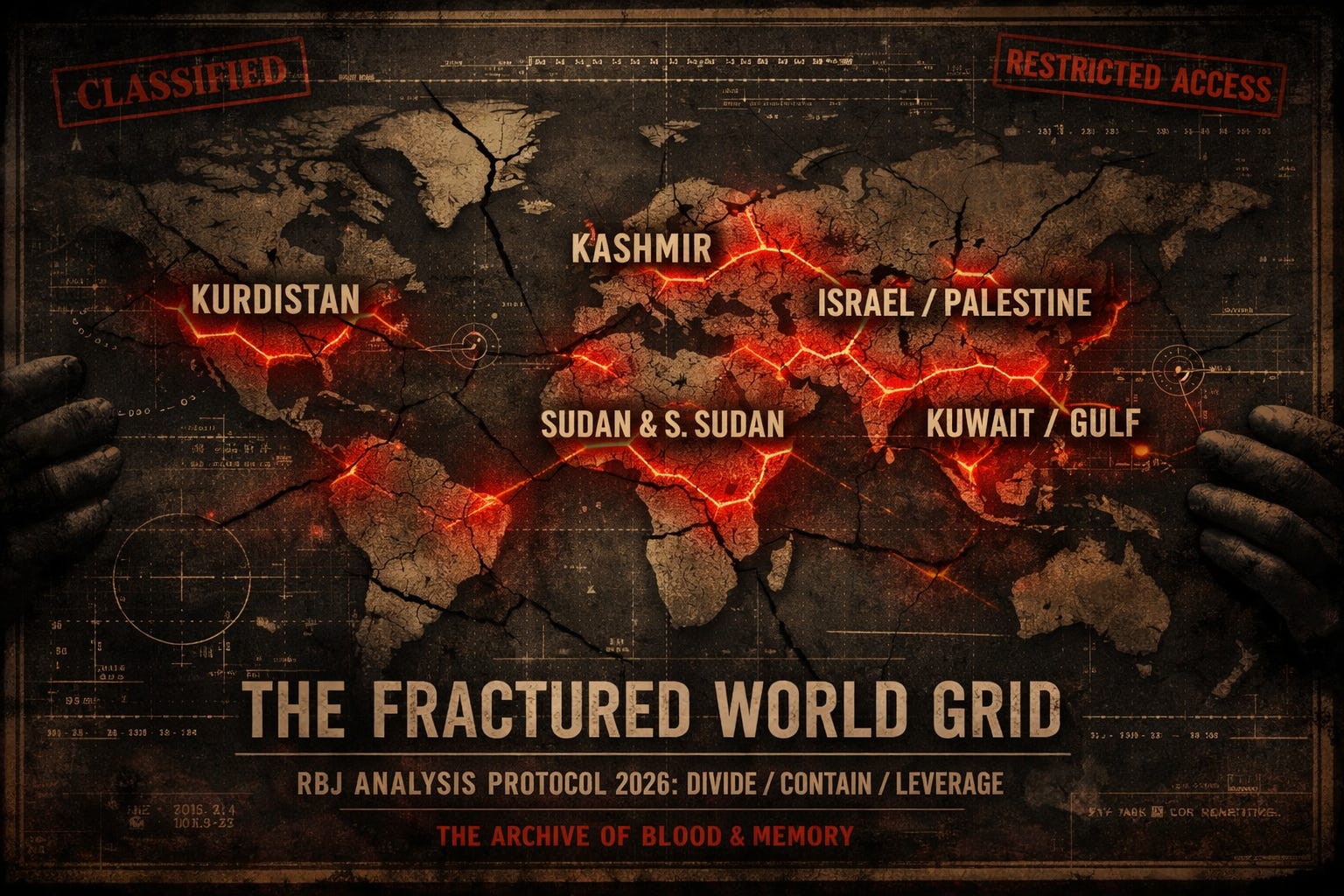
SECTION III — CASE CLUSTERS: THE GLOBAL FRACTURE GRID
🔻 Cluster A — Split Nations


Kurds (4 countries)
Pashtuns (2 countries)
Function:
Create multi-state dependency and tension loops
🔻 Cluster B — Partition Flashpoints


Kashmir (India–Pakistan–China)
Israel–Palestine
Function:
Permanent ideological and territorial contest zones
🔻 Cluster C — Strategic Micro-States


Kuwait vs Iraq
Gulf monarchies
Function:
Control of resources through fragmentation
🔻 Cluster D — Artificial Unity → Later Split


Sudan → South Sudan
Various African colonial borders
Function:
Delayed fragmentation—instability postponed, not prevented
SECTION IV — THE CONTROL LOOP
Across all regions, a recurring cycle appears:
📊 RBJ CORE MODEL — THE GLOBAL FRAGMENTATION LOOP
DRAW → DIVIDE → TENSION → TRIGGER → INTERVENE → FREEZE → REPEATPhase Breakdown:
DRAW
External or dominant power defines bordersDIVIDE
Populations are split or forced togetherTENSION
Identity and governance clashTRIGGER
Conflict emerges (organic or influenced)INTERVENE
External or regional actors step inFREEZE
Conflict pauses without resolutionREPEAT
Cycle reactivates under new conditions
SECTION V — THE MISUNDERSTANDING OF INTENT
The surface interpretation:
“This was designed purely as a long-term destabilization strategy.”
The deeper structural reality:
The initial motive was often:
Resource control
Strategic positioning
Administrative convenience
The resulting system, however:
Produced reusable instability
Created leverage points
Enabled influence without direct occupation
👉 Over time, the outcome became more important than the original intent
ANNEX A — NARRATIVE WARFARE LAYER
Each fragmented region carries competing narratives:
Liberation vs occupation
Security vs suppression
Sovereignty vs self-determination
These narratives are:
Reinforced through media
Weaponized in diplomacy
Used to justify intervention
ANNEX B — THE PRESSURE MAP (ABSTRACT)
Visualize the system as:
Nodes = Fragmented regions
Lines = Ethnic, economic, or ideological ties
External forces = Actors applying pressure
When pressure is applied to one node,
shockwaves travel across the network
ANNEX C — ENERGY & RESOURCE VECTORING
Many fragmented zones overlap with:
Oil corridors
Water systems
Trade routes
Examples:
Kuwait (oil gateway)
Kurdish شمال Iraq (energy corridors)
Gaza / Eastern Mediterranean (gas potential)
👉 Fragmentation often aligns with resource geometry
FINAL OBSERVATION — THE LIVING MAP
The map is not static.
It is a mechanism.
A system where:
Stability is temporary
Resolution is rare
Repetition is expected
Some regions cool.
None truly close.
🧩The Living Map:
A Global Fragmentation Protocol
This document explores how modern global borders act as calculated pressure points rather than permanent, peaceful divisions.
It argues that imperial powers historically engineered maps to fragment ethnic groups and isolate resources, creating a deliberate mismatch between cultural identity and political territory.
These artificial boundaries sustain a perpetual cycle of instability, characterized by a loop of tension, conflict, and external intervention.
By examining various “clusters” of unrest, such as the Kurdish regions or the partition of India, the text illustrates how geography is weaponized to maintain strategic control.
Ultimately, the source portrays the world map as a living mechanism where unresolved friction is a structural feature rather than an accidental byproduct of history.
